Vrhovine
_880_330_80_s_c1.jpg)
Lika destination area - Vrhovine
- Senjska ulica broj 48, 53223, Vrhovine
- 053 775 010
- 053 775 601
- opcina@vrhovine.hr
- web
The municipality of Vrhovine is a local self-government unit within the Lika-Senj County and is an area of special national interest. (The municipality is of special state concern). It covers an area of 224 km2, which is a total of 4.18% of the total area of Lika-Senj County, with 8 settlements, which ranks it sixth in terms of the size of local self-government units within Lika-Senj County.
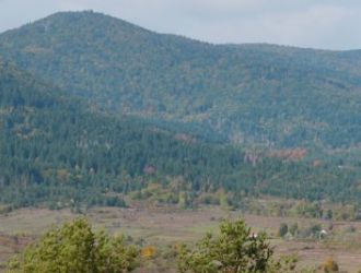
The territory of the Municipality of Vrhovina extends on the slopes of Mala Kapela between the Plitvička Jezera National Park and Velebit on the important transit traffic route D52 (which connects the Adriatic Sea via Senj, Otočac and Vrhovine with the famous natural beauties of Plitvice and the railway route that connects Zagreb and Rijeka with Dalmatia. the height of the territory of the Municipality of Vrhovine is between 500 (Zalužnica) and 1,150 m above sea level (Javornik), with a specific natural environment
The altitude of the territory of the Municipality of Vrhovine is between 500 (Zalužnica) and 1,150 m above sea level (Javornik), with a specific natural environment, which is characterized by, among other things:
* Rich and high-quality forest stock (mainly conifers)
* Unique biocenosis of habitats
* The immediate surroundings of a unique landscape of pearls of world-class natural beauty – PLITVICE LAKES NATIONAL PARK
* Appropriate pedological composition of agricultural land suitable for agriculture and animal husbandry, especially for the production of seed potatoes, fodder and medicinal plants;
* In terms of morphology, climate and nutrition, it is an extremely suitable area for the development of intensive and extensive animal husbandry and hunting;
* Characteristic mountain climate with sometimes "harsh" winters, and summers with warm days and cold nights;
Completely clean and unpolluted environment
Source: http://tzo-vrhovine.hr/


__velika_230_230_80_s_c1.jpg)
__velika_230_230_80_s_c1.jpg)
__velika_230_230_80_s_c1.jpg)
__velika_230_230_80_s_c1.jpg)
__velika_230_230_80_s_c1.jpg)
__velika_230_230_80_s_c1.jpg)
__velika_230_230_80_s_c1.jpg)
__velika_230_230_80_s_c1.jpg)
__velika_230_230_80_s_c1.jpg)
__velika_230_230_80_s_c1.jpg)
__velika_230_230_80_s_c1.jpg)
__velika_230_230_80_s_c1.jpg)
__velika_230_230_80_s_c1.jpg)
__velika_230_230_80_s_c1.jpg)
-2__velika_230_230_80_s_c1.jpg)
-2__velika_230_230_80_s_c1.jpg)
__velika_230_230_80_s_c1.jpg)
_330_250_80_s_c1.jpg)
_330_250_80_s_c1.jpg)
_330_250_80_s_c1.jpg)
_330_250_80_s_c1.jpg)
_330_250_80_s_c1.jpg)
_330_250_80_s_c1.jpg)

_330_250_80_s_c1.jpg)
_330_250_80_s_c1.jpg)
_330_250_80_s_c1.jpg)
_330_250_80_s_c1.jpg)
_330_250_80_s_c1.jpg)
_330_250_80_s_c1.jpg)
_330_250_80_s_c1.jpg)
_330_250_80_s_c1.jpg)